Nuovo articolo di Alessandro Merigo pubblicato su AstronautiNEWS.it.
3 Mi Piace
Rilasciate le prime immagini.
3 Mi Piace
L’Earth Fire Alliance ha pubblicato le prime immagini di incendi catturate dal satellite. Tra queste anche quelle di un focolaio in Oregon non visibile ai satelliti tradizionali.
Among the first images is a small fire in Oregon, USA, that was undetected by existing satellites, highlighting the opportunity FireSat presents to deliver insights missed by other space-based systems and to help first responders identify more fires in their early stages, assess their potential impact, and act before the fires escalate into public safety threats.
FireSat can detect fires as small as 5x5 meters, making it orders of magnitude more precise than existing satellites. Once fully operational, the FireSat constellation will scan Earth’s most fire-prone regions every 20 minutes, enabling unprecedented detection, monitoring, and characterization.
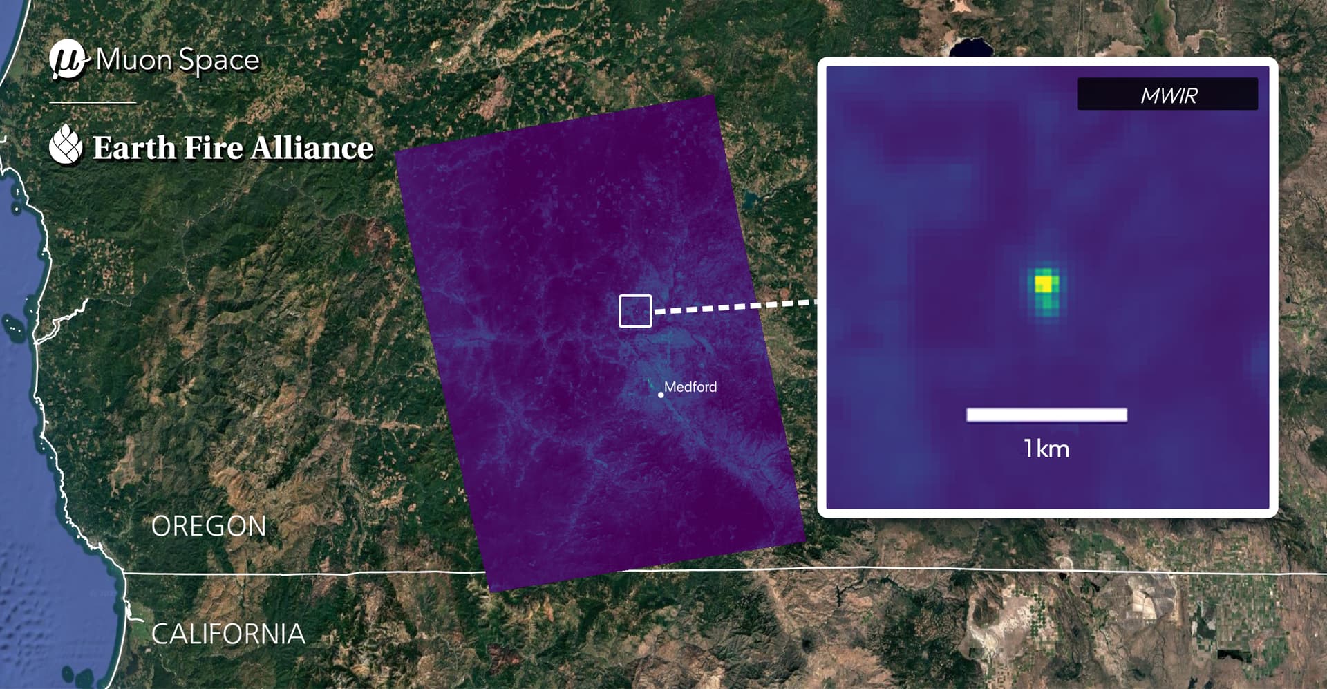
Oregon, USA: A small roadside fire undetected by existing space-based systems was identified by FireSat, showcasing the satellite’s superior sensitivity for early-stage fire detection. Credit: Muon Space and Earth Fire Alliance
2 Mi Piace